Latest Updates
Changelog
Recent updates for the site, premium tools, and release tracking. The newest updates appear first.
New Pro UI with Faster Page Loading
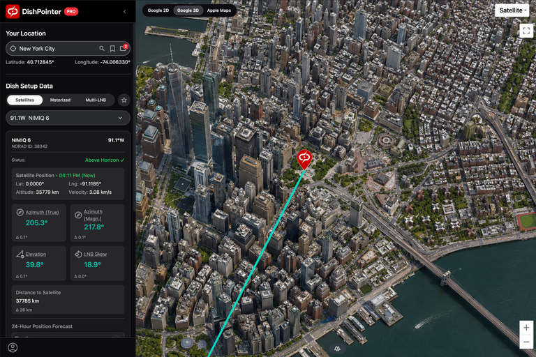
We made a set of changes to the user interface as well as under-the-hood improvements to help the site and maps feel faster and more responsive.
The Details
- All maps are now full screen
- Inclined satellites received a 24-hour forecast elevation graph
- Faster page loads: We trimmed background work so the site starts up more quickly.
- Increased the overall performance of the map display and updates of the satellite lines
Dish Height Slider & 3D Flyover Fixes
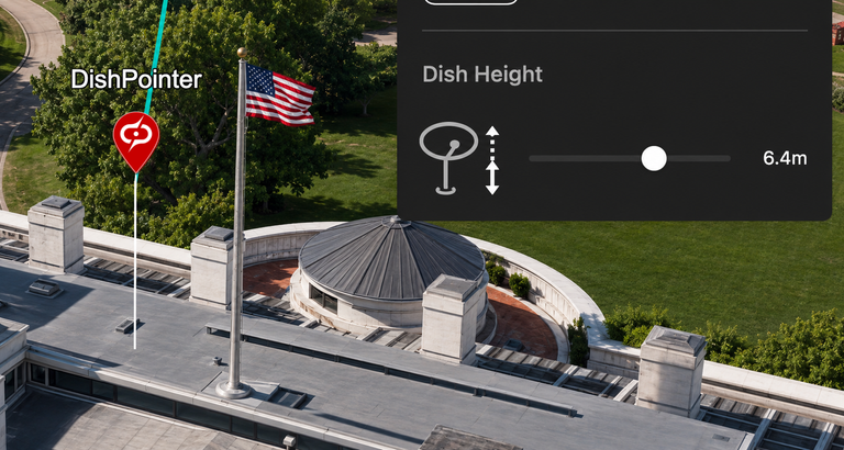
Two improvements that make the 3D planning tools smoother and easier to use.
The Details
- Smoother slider controls: The dish height slider now updates in real time without the stutter, making small adjustments much easier.
- Flyover fix: We fixed an issue where the 3D camera flyover could clip through objects or freeze when starting over an installation site. The camera path should now stay smooth from start to finish.
New Feedback Form
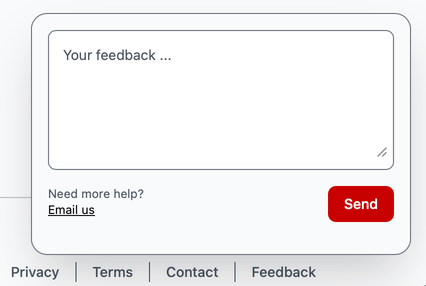
You can now open the Feedback form directly from the bottom bar.
Why we built it
Your feedback helps us improve DishPointer. You can now send feature requests, share comments, or report bugs without leaving the app.
Realtime Tracker and 24-Hour Forecast
![]()
We added new tracking tools for satellites in inclined orbits.
The Details
- Real-time orbit tracker: Follow the north-south figure-eight path of inclined satellites directly on your 2D and 3D maps.
- 24-hour alignment forecast: See when the satellite is expected to cross your dish's optimal line of sight over the next 24 hours, so you can plan ahead and better anticipate signal drift.
Saved Locations and Favorite Satellites
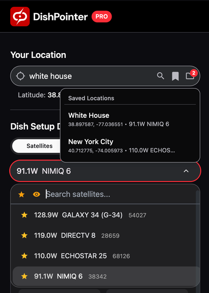
We added a few new tools to save time: store locations together with the selected satellite, show only satellites visible from your location, and mark frequently used satellites as favorites.
The Details
- Saved locations: Save and label frequently used installation sites for one-click access instead of entering the same coordinates again and again.
- Favorite satellites: Mark the satellites you use most often to keep a shorter, more useful list.
- Visible satellites filter: Show only satellites that are above the horizon at your current location.